ResilientWoodsHole Releases Interactive Tools for Public Input on Climate Impacts

ResilientWoodsHole (RWH), a public-private initiative led by local science institutions, has released new, interactive website tools to further engage the local community in the goal of securing a climate-resilient future for the coastal village of Woods Hole.
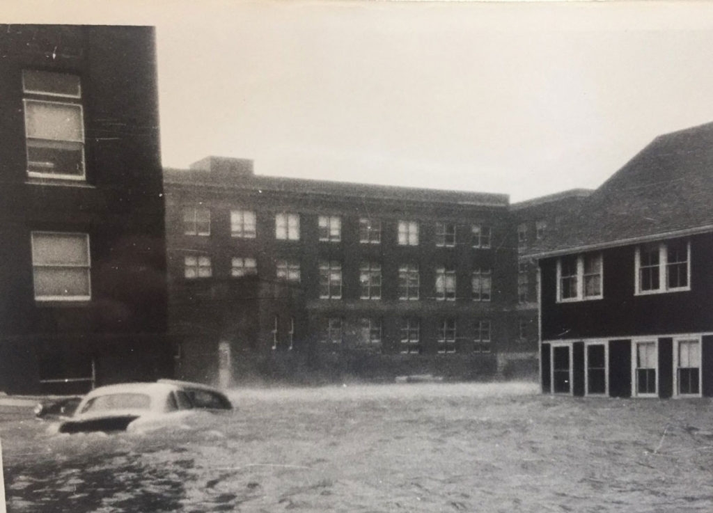
Everyone who lives, works or visits in Woods Hole is encouraged to share their input by exploring these tools. Community observations are essential for envisioning adaptation pathways for coming climate impacts, including sea-level rise and increased storms and coastal flooding.
One is a local stakeholder survey, now posted on ResilientWoodsHole's new website. Also posted are three interactive maps for public engagement. On the Flooding Risk map, personal observations of flooding in Woods Hole, past and present, are sought. On the Important Features map, the public can comment on aspects of Woods Hole that are of priority importance to protect. Finally, the Adaptation and Vision map invites comment on preferred long-term adaptation strategies for the village.
A recent public workshop held by RWH engaged more than 100 local community members in a dialogue about coastal flooding risks and possible adaptation strategies. Attendees contributed their thoughts on priority aspects of Woods Hole to protect, including community resources such as open space, recreation areas, beaches, vehicle/bike/and pedestrian pathways, and historic buildings.
Joe Famely, Climate and Sustainability Team Lead at Woods Hole Group, opened the workshop with an overview of storm and flooding impacts in Woods Hole, both historically and what the future is expected to bring.

“Now we are using all this information about vulnerability and risk to work with you, the stakeholders, to talk about what we can do to address these future impacts, and to engage in adaptation planning,” Famely said. “What types of solutions are we interested in exploring for Woods Hole? We will need figure out timelines for these solutions, and what the triggers may be for adopting and sequencing adaptation strategies to be responsive to changing conditions.”
“It is clear that the future of Woods Hole as a seaside community, blue-economy driver, and home to world-renowned ocean research organizations, lies collectively in our hands,” said Leslie-Ann McGee, manager of ResilientWoodsHole and a Director of Special Projects at Woods Hole Oceanographic Institution. “Working with the community, it is our goal to prepare for sea-level rise and increasing extreme weather events, and jointly develop solutions.”
"The MBL campus stretches through the whole village, from Stony Beach to Water Street," said MBL Chief Operating Officer Paul Speer at the workshop. "Any climate protections we put in place, as an institution, will roll back into the community and potentially impact other properties and neighborhoods. So we are trying to be as aligned as possible with homeowner and business interests as we all move forward with resiliency planning."
This effort is funded through the Massachusetts Office of Coastal Zone Management (CZM),’s Coastal Resilience Grant Program and matching funds from Woods Hole Oceanographic Institution, Marine Biological Laboratory, and NOAA Fisheries.
###
ResilientWoodsHole is a private-public initiative to ensure that the vibrant and productive village of Woods Hole prospers well into the future with the advent of major climate impacts. Led by a collaboration between Woods Hole Oceanographic Institution (WHOI), Marine Biological Laboratory (MBL), and NOAA Northeast Fisheries Science Center (NOAA Fisheries), the initiative also includes local stakeholders, including the business, residential and science communities. The Town of Falmouth, the Massachusetts Office of Coastal Zone Management (CZM), and the Woods Hole Group are active partners in ResilientWoodsHole.